
Hema Flinders Ranges Map Multicoloured
Quantity
-
Detail
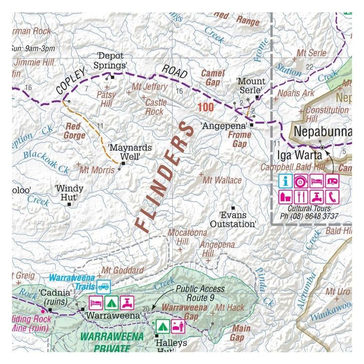
A waterproof map of the Flinders Ranges with inset national park maps of Flinders Ranges National Park and Vulkathunha-Gammon Ranges National Park. Visitor information for both the national parks, the Leigh Creek region and the Blinman region make trip planning and navigation simple, with accompanying tourist information including self-drive treks, historic sites, necessary contact details and listed national parks and reserves. Marked on the maps are camping areas, points of interest and more.
- Features
- Printed on waterproof and tearproof paper
Features information on major 4WD tracks
Major tourist attractions and road distances marked
National parks marked including contact information and events
Camping areas and points of interest included throughout
GPS surveyed roads and tracks
- Primary Activity(s)
- Travel
4WD & Offroad
Caravanning
- EAN 9321438001607, 9781865007151, 9781925625578
-
Customer ReviewsNo comments